Page History
| Excerpt | ||
|---|---|---|
| ||
Summary of photographic survey plates used in construction of GSC |
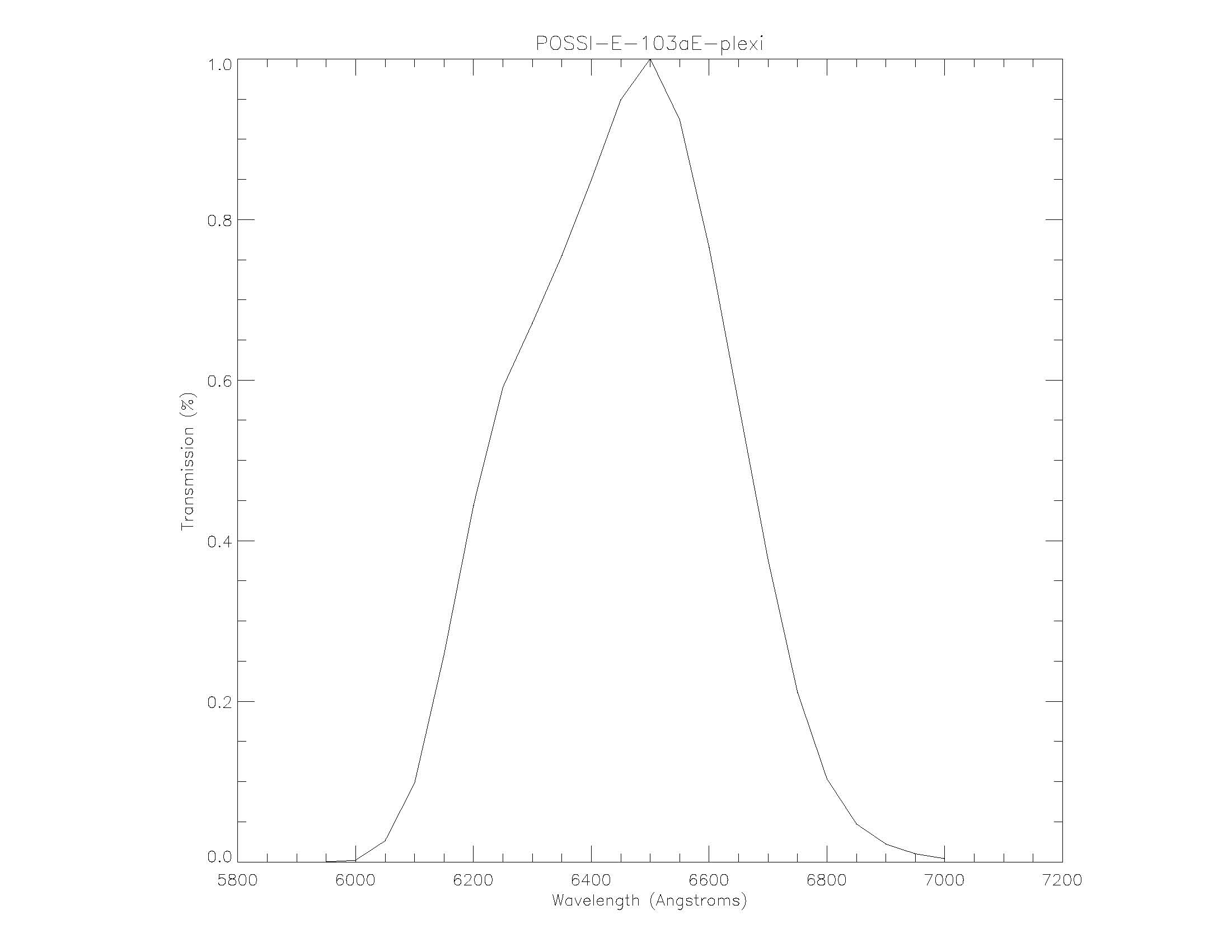
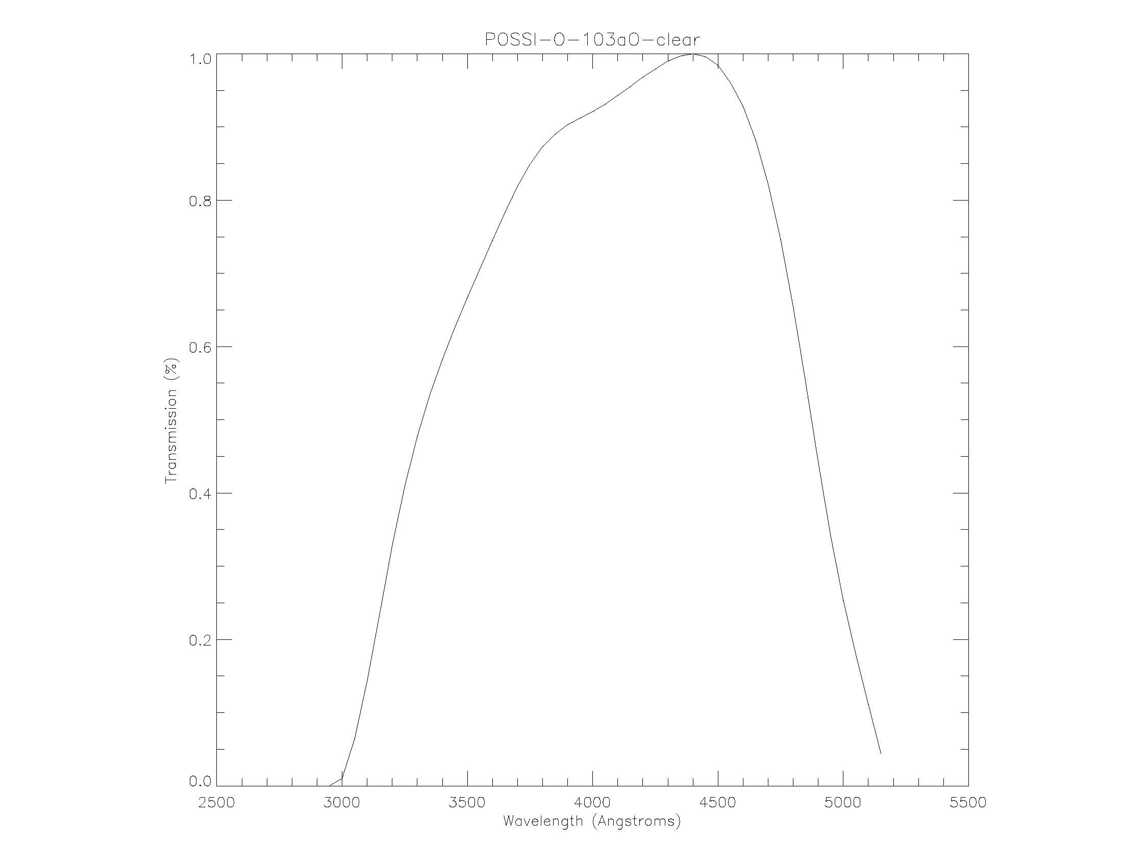
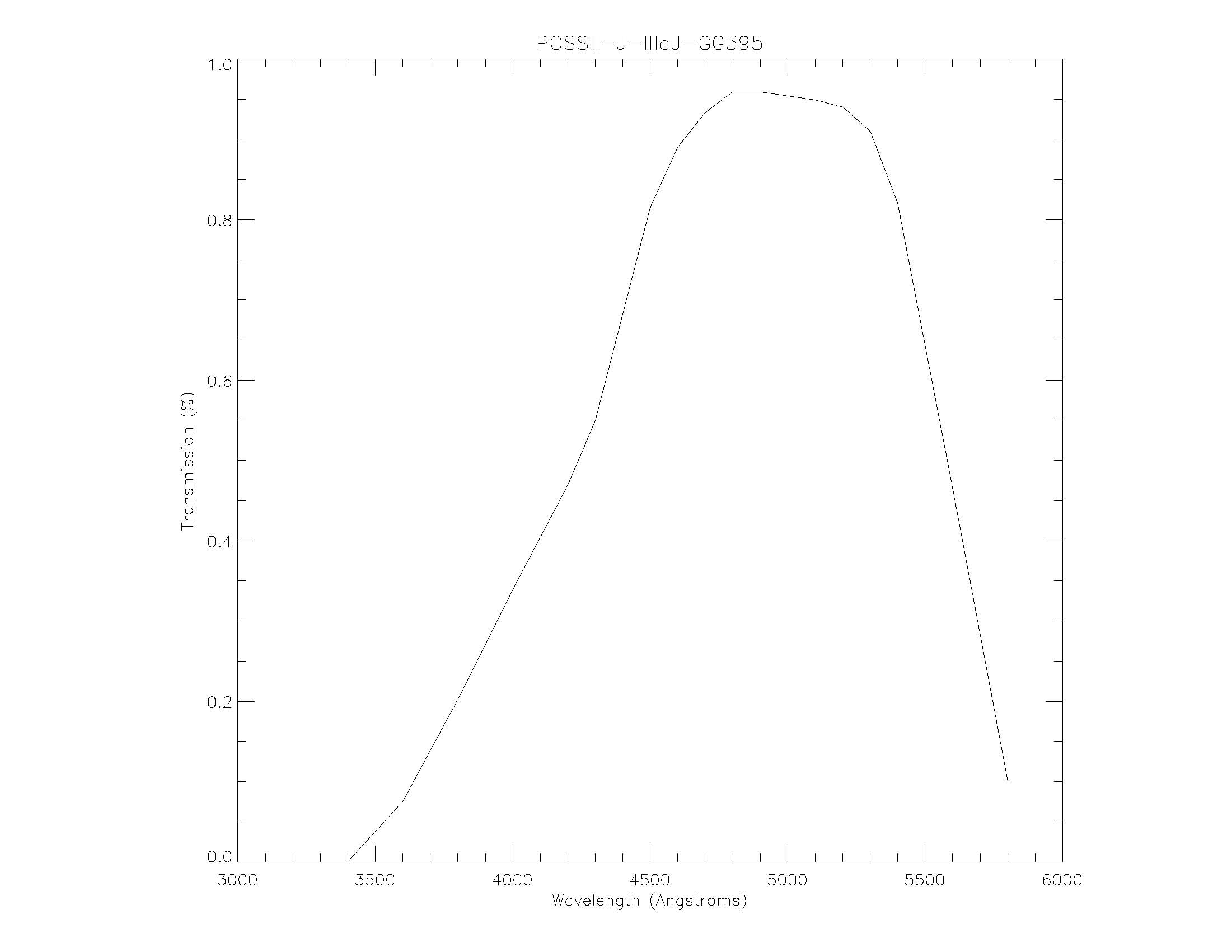
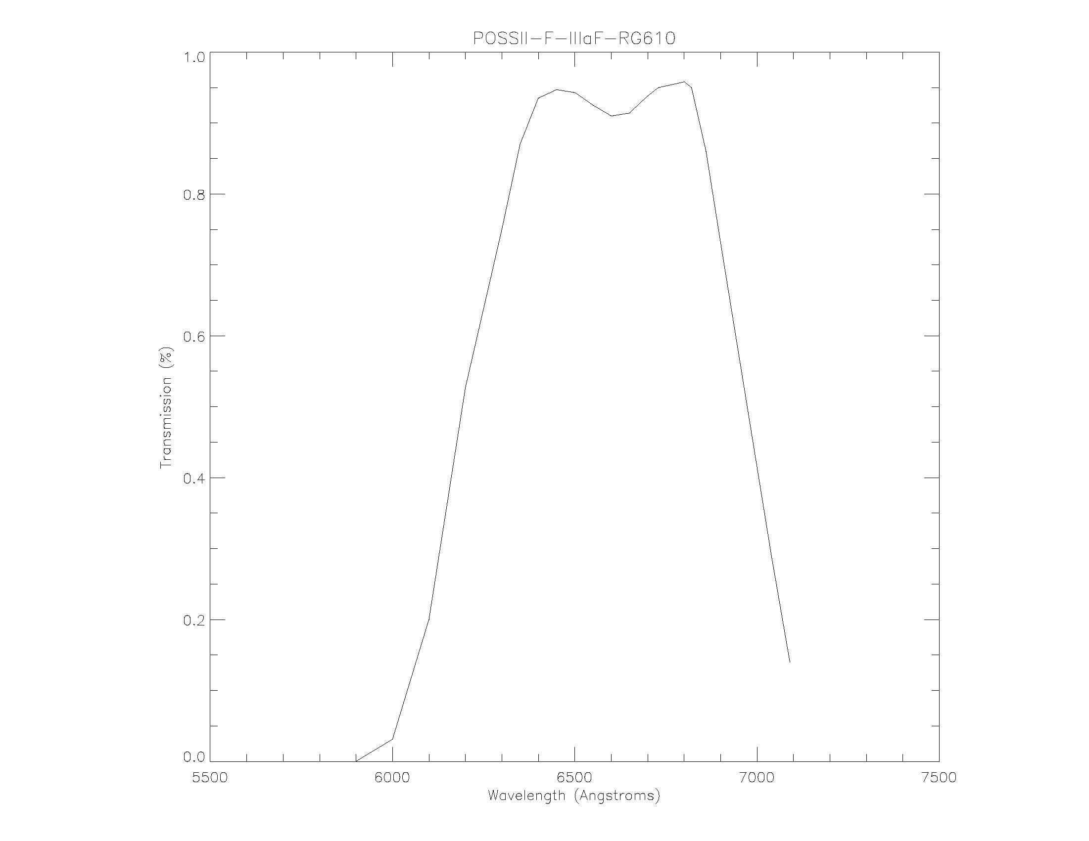
This table summarizes the photographic survey plates used in the construction of GSC-1 and GSC-2. The northern sky was observed using the Palomar observatory 48" Samuel Oschin telescope, whilst the southern sky was observed using the UK Schmidt telescope at the Anglo-Australian Observatory. These photographic glass plates were then digitized by STScI and processed to create the Guide Star Catalogs. The initial set of scans only included a single plate for each region of the sky and were published as the Digitized Sky Survey (DSS-1) and processed into GSC-1 to support HST operations. After the initial release, a DSS consortium came together to both obtain additional second epoch plates, digitize at a higher resolution and process them into DSS-2/GSC-2. Whilst there are exceptions, the bulk of the sky has observations in at least 3 bandpasses (blue, red and near-IR).
Survey Name | Survey Code | Epoch of observations | Photographic Emulsion +filter | Band Name | Approximate limiting Magnitude | Declination zone / coverage | Number of plates | DSS pixel size in arcsec | GSC version | DSS version | DSS Copyright holder |
|---|---|---|---|---|---|---|---|---|---|---|---|
POSS-I E | XE | 1950-58 | 20.0 | +90:-30 | 936 | 1.0/1.7" | 2 | 1 | STScI | ||
POSS-I O | XO | 1950-58 | 21.0 | +90:-30 | 936 | 1.0" | 2 | 2 | STScI | ||
Pal-QV | N | 1983-85 | 19.5 | +90:+06 | 611 | 1.7" | 1+2 | 2 | STScI | ||
POSS-II J | XJ | 1987-98 | 22.5 | +90:+00 | 897 | 1.0" | 2 | 2 | Caltech | ||
POSS-II F | XP | 1987-98 | 20.8 | +90:+00 | 897 | 1.0" | 2 | 2 | Caltech | ||
POSS-II N | XI | 1987-02 | 19.5 | +90:+00 | 890 | 1.0" | 2 | 2 | Caltech | ||
SERC-J | S | 1975-87 | 23.0 | -20:-90 | 606 | 1.7" | 1+2 | 1 | ROE | ||
SERC-EJ | S | 1979-88 | 23.0 | -00:-15 | 288 | 1.7" | 1+2 | 1 | ROE | ||
AAO-SES | XS | 1990-98 | 22.0 | -20:-90 | 606 | 1.0" | 2 | 2 | AAO | ||
SERC-ER | ER | 1984-98 | 22.0 | -00:-15 | 288 | 1.0" | 2 | 2 | AAO/ROE | ||
AAO-SR | GR | 1996-99 | 14.0 | Southern galactic plane | 116 | 1.0" | 2 | 2 | AAO | ||
SERC-I | IS | 1990-02 | 19.5 | -00:-90 | 894 | 1.0" | 2 | 2 | AAO | ||
SERC-QV | XV | 1986-88 | 14.0 | Southern galactic plane | 94 | 1.0/1.7" | 1+2 | 1 | ROE | ||
SERC-V | XX | 1979-85 | IIIaJ | Vpg | variable | M31, LMC, SMC | 4 | 1.7" | 1+2 | 1 | STScI/ROE |
DSS Data Access
The Digitized Sky Survey images are available on-line from a number of data archives around the world as well as built-in to astronomical data viewers such as Aladin, Worldwide Telescope and Google Sky. The data may be retrieved directly from STScI/MAST using the links and/or API's described below:
| Get image cutout (FITS or GIF format) | https://archive.stsci.edu/cgi-bin/dss_form | DSS Image Access : http://archive.stsci.edu/cgi-bin/dss_search?Parameters Required Parameter List
Optional Parameters
e.g. |
| Identify available plates to cutout | https://archive.stsci.edu/cgi-bin/dss_plate_finder | DSS Plate Finder : http://archive.stsci.edu/cgi-bin/dss_plate_finder?Parameters Required Parameter List
Optional Parameters
e.g. |
| Get image cutout (color JPG) | none | DSS JPG Image Access : http://gsss.stsci.edu/webservices/dssjpg/dss.svc/GetImage?Parameters Required Parameter List
Optional Parameters
e.g. |